UgCS provides a comprehensive set of tools to solve your problems and technical requirements. Whether it is a simple device, complex system, or complete solution, we are happy to serve you!
UgCS by SPH Engineering is a world-famous flight control and UAV mission planning software solution. The software has undergone constant advancements for the last seven years to provide better services.
It has been specifically designed to meet the global needs of drone pilots and professional surveyors. Initially developed in the EU, today, this software solution has become a global unified mission planner for all UAV platforms.
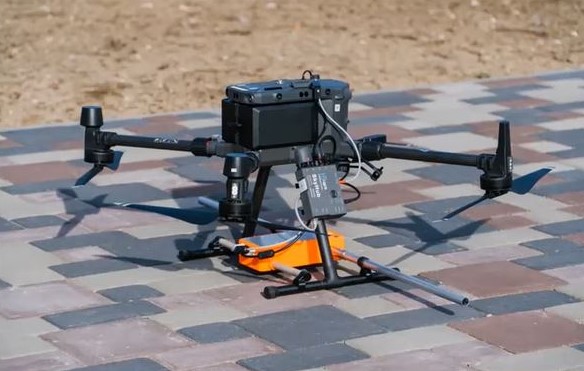
Being a leading drone control software, UgCS supports some f the most popular UAV platforms such as DJI M600, M200 Inspire, Phantom 4, etc. UgCS integrated drone systems incorporate UgCS software, a sensor, the UgCS SkyHub onboard computer, and the UgCS True Terrain Following radar.
Luckily, this integrated system can be applied to multiple sectors such as Power, Construction, Oil & Gas, and Public Services. However, to enjoy the features of this integrated system, you require a UgCS license.
There are two types of licenses – UgCS Pro and UgCS Enterprise. While UgCS Pro includes professional flight planning solutions, UgCS Pro Plus or enterprise is ideal for video surveillance, LIDAR surveys, and infrequent applications.
Now that you have a brief idea about UgCS integrated systems, let’s have a look at some of the most popular UgCS drone-based integrated systems that are used for hydrographic, geophysical, industrial, and archeological surveying as well as environmental monitoring.
UgCS SkyHub
A specially designed onboard computer, UgCS SkyHub is used to improve the efficiencies of commercial UAVs to serve industrial purposes and to support varied sensor integrations. Initially, UgCS SkyHub 1st generation hardware was developed to incorporate a low-frequency GPR system with a DJI M600 Pro drone.

Since then, the functionalities of UgCS SkyHub have been constantly updated and improved so that it can support several other types of drones including DJI M300, DJI M210 series, PX4 firmware, and Pixhawk-based drones with ArduCopter.
Key Functions of UgCS SkyHub
Helps DJI Drones to implement True Terrain Following. This automatically keeps the drone over the surface by using real-time data from radar or laser altimeter.
- It implements the Grasshopper mode when a drone flies between waypoints at a safe altitude, or at a set altitude to make measurements, drop a parcel, etc.
- It saves the drone by acting as a support for external detectors of obstacles that can cause interruptions to flights.
- It gathers data from sensors like methane detector, Ground Penetrating Radars (GPRs), gamma radiation counters, etc., that lack an internal data logger.
- Non-geotagged is of no use. Thus, UgCS SkyHub helps in data fusion from Autopilot and Payload telemetry. It uses data from the drone to geotag information captured by the sensor.
BathyMetric Drone
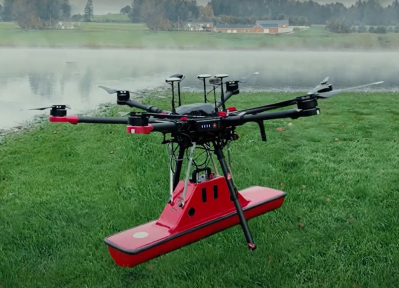
Bathymetry drone-integrated system comprises an Unmanned Aerial Vehicle (UAV) drone incorporating an echo sounder or GPR system.
Furthermore, adding UgCS SkyHub, the onboard computer to the system ensures full integration. Integrating a radar Altimeter into the drone system allows the drone to follow the terrain precisely, depending on the data collected from the Altimeter.

BathyMetric drone measures the depth of water level and sediments quickly and efficiently. This integrated system is easy to deploy anywhere and can operate at hard-to-reach locations such as mining pits, terrain obstacles, steep coasts, shallow waters, ponds, lakes, and canals.
It surveys unsafe and hazardous environments much faster than traditional survey methods using a boat, ship, or unmanned surface vehicle.
Key Functions of BathyMetric Drone
- It is useful for collecting information in those areas where it is impossible to reach by foot. Also, these drone system does not require wide points of entry to the water for deployment.
- Due to fast deployment and easy transportation, BathyMetric drone systems can capture data 10 times faster than traditional survey methods.
- It operates efficiently in environments that are extremely unsafe and hazardous for humans. Even in harsh conditions, it works without contacting water. Thus, it acquires data from lakes and rivers having strong currents as well as contaminated waters.
- It’s precise positioning while following the survey route, and capability to fly at a consistent speed as well as specified low altitudes lead to high accuracy measurements.
MagDrone
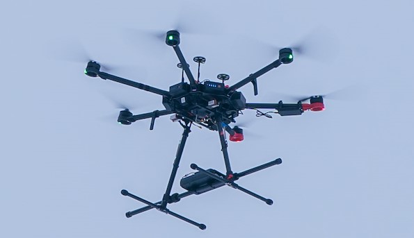
MagDrone is an integrated system that combines a drone with a precise altimeter and a sensitive magnetometer to detect any magnetic or metal materials lying underground. Please note that this magnetometer is not an active sensor. Rather, it only measures the magnetic field at the specified point where it is located.

That being said, it is very essential to fly this integrated drone system as close to the surface as possible to detect the objects. However, the best thing about using this magnetometer system is that it is very light and compact, thus, it can carry any drone with a payload capacity of 1kg.
Key Functions of MagDrone
- Compared to handheld devices, this magnetometer-integrated drone system scans and detects metals much faster. Furthermore, it also helps in obtaining geo-referenced maps of the area.
- Its main component, UgCS-flight planning software, provides tools for creating and calculating flight pathos easily as well as interpreting acquired data in a user-friendly manner.
Bottom Line
Hope this blog helped you learn some of the common types of UgCS by SPH Engineering drone systems and their uses.
Perhaps you may find several resellers or agents on the web that sell integrated aerial systems. Just make sure to avail UgCS integrated systems from a top-rated reseller so that you can receive outstanding service.